We need to start experiencing the joy of being both embedded in community and connected to the natural world.

Helena Norberg-Hodge


Economic prosperity must go hand in hand with social cohesion and ecological sustainability

Mikhail Gorbachev


Friday, September 30, 2011

Klein River Estuary. Another resignation.


Klein River Estuary artificial breaching resignation. 
This time Nicholas Clark


 Dear Rob
I hereby tender my resignation from KREF.
As I represent the Hermanus Yacht Club, I will attempt to find another member of HYC to be on KREF.
Prior to the breaching subcommittee meeting Sue told me telephonically that they(?) were concerned that the mouth would breach naturally and that the position of the breaching would not be in the desired location. They were thus going to breach the mouth at the eastern side to prevent a breaching in the west at the lowest point. With this in mind I naturally went and re-read the Mouth Management Plan and have read Notice of Breach and the report you sent out yesterday.
I may be wrong but my reading of the Management Plan is that a natural breaching is the ideal option. My reading of section 2.3.7 is that there are three independent criteria to determine the position of the breaching. I must assume that they are listed in order of importance.
I notice in the Post-Breaching Report on page 4 para 3, page 6 point 4.3, page 24 point 5.5 that these three criteria have been morphed into two. This makes the justification of the location of the opening easier to support.
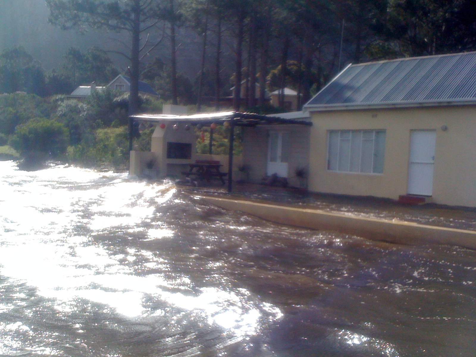
I was surprised to see an extract of the survey I did included in the report. I have included a full copy of it with this mail. The back ground image is confusing. The small cup shape in the east is the small water line indentation that existed amongst the dunes. The start of the dunes is to the west of that position and not to the east as this old image indicates. (So the breaching was also not near the middle of the berm). The amount of estuary survey coverage on the bulk of the dune is not nearly sufficient to be used in any decision making for opening. I did have more coverage at the eastern end which were the two obviously low points. From this amount of coverage a contour plan can be generated and low points determined. The whole berm should have this amount of coverage. I am surprised as well as this survey that was done more than a month before the opening and was used in the report. I could have been asked to come and do a better survey once the a decision was made to breach. I must assume that my opinion raised, about the position of the breaching, in the discussion with Sue prevented this. As pointed out in the report the berm is very flat and the differences in height are small. This is true for a large section of the berm. I thus find it concerning that the method used by Sue and Ed  to determine the height is so rudimentary. Technology is available that can give far more accurate results. I must assume that the lowest point is not really one of the criteria that is taken seriously. All of the measurements that were taken are worth nothing because of the throw-away sentence on page 10 at 9:00. The berm had changed overnight and we had a new position to open it. What a pity a photo and measurements of the change is not included in the report. Strangely enough no such change had happened in the month preceding that with much higher winds and seas.
I am pleased to see that flooding of house was not a reason for breaching but distressed to see that part of the motivation of the position of the breach is to save the car park. With repeated opening of the mouth in one position the main channel must move. The eastern opening was chosen in the past to enlarge the recreation area at the mouth and so that sand mining could happen. Both of these activities can not occur with a western opening.
I wish you luck with your future endeavours with KREF.
Regards
Nicholas

Sunday, September 25, 2011

Klein River artificial breaching a complete failure


Local knowledge ignored by KREF the local body mandated to manage the Klein River estuary. Below is a letter from the  Kenilworth Hermanus Scout Camp who have been camping on the site for an unbroken 100 years 

 If this should consern you call Sue Mathews 0833815432 or Rob Fryer 0721855726


River flowing to recent breached mouth in distance

Campsite cess pit high and dry due to incorrect breach east of berm

Dear Noon,
As recommended by you, I am enlisting the support of the aesthetics committee in regard to the scout camp site at Die Mond. As you know, we, the Kenilworth Hermanus Scout Camp have been camping on that site for an unbroken 100 years during the months of December and January for approximately 2 weeks each year. For the first 90 of those years, the site was more or less pristine and the water in front of the site was clean and clear and about 20ft deep and connected to the main body of the Hermanus lagoon. For the last 10 years situation has been deteriorating due to continuous artificial annual breaching of the berm in an easterly position thereby causing silting which has separated the water in front of the campsite from the main lagoon by a kilometre of seasand. This has been aggravated by the sewage department spilling copious quantities of raw sewage into the water in front of the campsite. This has resulted in the resultant pond becoming a cesspit unfit for any recreational purposes. The above is despite numerous appeals to the powers that be (KREF, OCF, Cape Nature) to manage the mouth differently. I therefore urge you to put pressure on the mayor and her council to do something, preferably before December, to restore the site to its former pristine glory.
Maybe you could point out just how inefficient the recent artificial opening was for the following reasons:
1. the breaching took place when the water level was 20cm below the level of the berm which resulted in 2.5 billion litres of water    not being available for scouring.
2  the extreme eastern opening caused the main channel to do a complete U-turn before entering the sea and thereby disippating huge amounts of energy and therefore silt-carrying capacity.
3 the opening took place at a time when the tidal system was nearer the neap tides than the spring tides also causing a huge loss of potential silt carrying capacity and scouring effect.
4 At the time of the opening there was an extremely strong westerly wind blowing the water inland thereby also reducing the scouring and silt-carrying capacity.
Intelligent consideration of these 4 points would have gone a long way to correcting the untennable situation described above.
I trust that you and your committee will view this site with the status that it deserves and apply the necessary pressures.
Kind regards,
Antony van Hoogstraten (Hoogie)
Chairman of the Camp Committee
Letter sent to;


john@whale.co.za, lloydn@hermanus.co.za, Nigel.Gwynne-Evans@pgwc.gov.za, morgan_griffiths@yahoo.co.uk, krichardson@wbhs.org.za, gregsimpson@telkomsa.net, Geoff.DuToit@shands.co.za, reivey@iafrica.com

Saturday, September 10, 2011

Friday, September 9, 2011

Fall-out over Klein River Estuary premature artificial breaching on Friday 9 September 2011


Letter of resignation from Antony van Hoogstraten

----- Original Message -----
From: Carol
Sent: Friday, September 09, 2011 8:30 AM
Subject: Lagoon Breaching

Dear Rob,
It is a basic tennant of Nature Conservation that you leave nature to its own devices wherever possible. You are now prematurely opening the Hermanus lagoon at least 6 weeks prior to the end of our rainy season. You seem to have ignored the spring high tides which are in 5 days time. By opening the lagoon in the centre of the berm you are reinforcing an error of at least 10 years standing which has caused the deteriorating cesspit in front of the Scout Camp site and a cutting off of that body of water from the main vlei. Between Sue and yourself you have not come up with any proposal to correct this recent deterioration. According to Sue, of yesterday this kneejerk action is not a result of public (David Abbot) pressure, but if it is, you should have come out publicly and said so.
In my opinion You and Sue, sadly, have become part of the problem and not the solution. I therefor resign from KREF and the OCF with immediate effect.
Yours faithfully,
Antony van Hoogstraten

Thursday, September 8, 2011

Klein River Estuary planned artificial breach been subverted by legal threats

VIEW THE PROPERTIES CREATING THE POLLUTION IN THE ESTUARY
http://truthabouthermanus.blogspot.com/2011/09/hermaus-lagoon-is-can-of-worms.html

The breaching subcommittee of the Klein River Estuary has been subverted by threatened legal action by some water front property owners. This has led to the announcement of a artificial breach planned for the 9th September. The estuary water level of 2.7m msl.

The blog posting below illustrates the dichotomy of the set back line controversy.

In simple terms it spells coercion. The subcommittee has been coerced into silently approving a breach under threat of legal action, by the very same property owners (properties seen in the photographs below) that have built their homes below the high water line.

Follow this carefully; The present water level is 2.7m msl and it should go to 3m msl for a natural

or artificial breach. Now look at the photographs and see where the properties would stand if the level would be at 3m.

Environmental Affairs, Cape Nature and KREF are in dereliction of their mandates and duties to manage the estuary in terms of their very own rulings.

They have been blackmailed by the property owners and the estuary has been held to ransom by some 'fat cats' who think they own the place.

We will not insist that these properties be demolished and their septic tanks be filled with concrete (which could be suggested) but we will insist on the following;

We are calling for the enforcement of the set back line - 5m above the 3m msl and the instillation of CSIR certified conservancy tanks for all properties falling within this window.

We are also calling for the resignation of all the town planners involved with the approving of the plans of the buildings seen in the photographs below.

Further, there must be a moratorium on all building activities around the estuary until all these submissions have been addressed to there fullest implication.

Below is a letter from KREF anouncing and justifying a pemature artificial breach planned for the 9th September


Klein River
Estuary
FORUM

2011-09-08
Notice of Planned Artificial Breach of the Klein River Estuary
in Terms of the
Maintenance Management Plan: Artificial Breaching of the Klein River Estuary
(DEA & DP Ref No. E12/2/4/7-E2/14-CJ2014/11 dated 2011-03-25)


The breaching subcommittee of the Klein River Estuary Forum, comprising of representatives of
the Overstrand Conservation Foundation, Cape Nature and the Overstrand municipality’s
Environmental Management section, met on 2011-09-07 under the chairmanship of Rob Fryer.
The purpose of the meeting was to review the status of the Klein River Estuary relative to the
criteria and guidelines for artificial breaching set out in the Klein River Estuary Mouth Management
Plan.
The outcome of the meeting was the decision to plan the artificial breaching of the Estuary mouth
at an appropriate time between the 9th and 12th of September 2011.
The time of the breaching will depend upon weather and sea conditions. The earliest the breach
may occur is at high tide at 14:00 on Friday 9th September.
Property owners with Estuary water frontage are advised to take any necessary precautions in
anticipation of the breach. The public is warned that the breaching activities involve earthmoving
activities on Grotto Beach and that the site of the breach is dangerous due to unstable sand banks
and strong currents. People are advised to observe from a distance and not to approach the area
in which the breach is made.
The breaching subcommittee satisfied itself that the prevailing circumstances warrant performing
an artificial breach and that the decision is fully consistent with the Mouth Management Plan, for
which the Department of Environmental Affairs and Development Planning (DEA & DP) issued
environmental authorisation. Advice was obtained from reference specialists. The decision was
unanimous.
Amongst the many factors considered prior to making the decision, the following are considered to
be the most important:
1 The water level in the estuary has been steadily rising with the winter rainfall and has reached
2.77 m above mean sea level (amsl). It is evident from the only very slight increase in level
following the most recent rain storm that the level has plateaued.
2 The minimum berm height at the estuary’s mouth is 3 m amsl. This occurs at 3 positions
along the berm. Only one of these low points occurs at the preferred breaching point.
3 The weather forecast for the next week, with minimal rainfall anticipated, indicates that it is
unlikely there will be any further rise in water level, which may even drop due to evaporation
and seepage through the berm. The rainfall required in the Klein River Catchment to raise the
estuary’s water level to the 3 m amsl berm low points is estimated to be in the region of 100
mm. It is therefore unlikely that a natural breach will occur within the August to October
window within which we are authorised to effect an artificial breach.
4 While salinity levels are not deciding criteria within the Mouth Management Plan, the salinity
has reached unprecedented low levels (10 ppt). Recent observations of sand snake eels
Page 2 of 2
Klein River
Estuary
FORUM
(Ophisurus serpens) in shallow water along the berm have provided early indications that this
may be causing stress to some species in the estuary.
5 Several illegal attempts have been made to artificially breach the estuary at positions that are
not preferred for optimal scouring of silt from the estuary and which may lead to erosion of the
Grotto Beach and its car park. The danger exists that further illegal attempts at inappropriate
positions or unfavourable sea conditions might succeed to the detriment of the estuary.
The breaching subcommittee concluded that the preferred natural breach is unlikely to occur, and
that the circumstances are such that an artificial breach should be performed to promote
ecosystem health of the Klein River Estuary and preserve its value as a nursery area for fish.
DEA & DP have been notified in accordance with the conditions contained within the environmental
authorisation.
Yours faithfully
Rob Fryer
Chairman

TEL +27 28 313 2025 FAX 086 695 0046 CELL +27 72 185 5726 E-MAIL wcc@ocf.org.za WEBSITE www.whalecoastconservation.org.za
U1 Gateway Centre, Main Rd, Hermanus PO BOX 1949 HERMANUS SOUTH AFRICA 7200
PBO 18/11/13/4541 NPO 020-717
e:\klein\breaching\kref breach notice 20110908.doc


Tuesday, September 6, 2011

Some of the Klein River Estuary properties falling below the set back line


All the photographs (seen below) were taken on Saturday 3 September
2008

Klein River Estuary water level was 2.77 m msl at the time.

3m msl is understood to be the maximum natural breaching height

(THE 5M SET BACK IS SAID TO BE THE NEW RESTRICTED BUILDING LINE)


Johnson property


Owner unknown


Owner unknown


McCarthy property


McCarthy property

McCarthy property


Mosaic Farm (Lodge)