Sunday, January 23, 2011
SCHULPHOEK IS KHOISAN LAND

HERMANUS MUNICIPALITY PUMPS SEWAGE INTO LAGOON


Saturday, January 22, 2011
TOWN PLANNING CORRUPTION 2
Friday, January 21, 2011
Hermanus Yacht Club in the s . . . Sewage
Tuesday, January 18, 2011
HERMANUS TOWN PLANNING CORRUPTION 4
Friday, January 14, 2011
Hermanus Lagoon Pollution
HERMANUS BLUE FLAG BEACH THREATENED

HISTORIC ARNISTON JUDGEMENT AGAINST A MUNICIPALITY AND DEVELOPER
Background: 2009. Verreweide Eiendomsontwikkeling (Edms) Bpk was the registered owner of Erf 599 Waenhuiskrans and sought to develop the property with a view to establishing a business centre comprising inter alia, shops, holiday apartments and basement parking in the center of historic WAERNHUISKRANS - ARNISTON
Now the case can be summarized as follows; The matter was between Waenhuiskrans Arniston Ratepayers Association ( First Applicant ), Waenhuiskrans Action Group ( Second Applicant ) and Verreweide Eiendomsontwikkeling (EDMS BPK) ( First Respondent ) , Cape Agulhas Municipality ( Second Respondent ) , The Registrar of Deeds ( Third Respondent ); and Judgment in the Case No. 1929/ 2008. by Acting Judge De Swardt A.J. on 19 November 2009.
Concluded: The decision by Cape Agulhas Municipality to extend the re-zoning of the site following the lapse of the zoning in terms of section 16(2)(a) of LUPO was set aside in terms of this judgment, and the judgment has clearly earned a measure of credibility having withstood appeals to the Supreme Court and the Constitutional Court.
The case can be found here:
http://www.saflii.org/za/cases/ZAWCHC/2009/181.pdf
STOP INAPPROPRIATE DEVELOPMENTS
The rights of Communities, in particular the MFMA and PAJA ; and the belief that it is possible for Communities and Residents Associations to stop inappropriate developments promoted by Municipalities and greedy Developers is very true and is happening all around us.
HERMANUS LAGOON POLLUTION LEVELS 'OFF THE CHARTS'


Wednesday, January 12, 2011
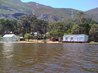
HERMANUS LAGOON (Klein River Estuary) Pollution
TOWN PLANNING CORRUPTION 1

DEBATING WHERE THE SET BACK LINE SHOULD BE
NEMA depicts an estuary as a „water body‟, in which case set back is 32m. It is important that NEMA and the ICM Bill are aligned (and likewise the EIA regulations).
Henk Olivier of Overstrand Municipality’s planning department noted that DWAF does not allow development below the 50 yr floodline but nevertheless also requires that you show the 100 yr floodline in applications but this is not always of practical use.
Currently DEA&DP are using the 1:50 yr floodline, as is DWAF. MCM is also considering whether this is an acceptable setback line. Part of the problem is that in an estuarine environment the appropriate level for development is localized so that in one part of the estuary it may be the 1:50 year floodline, whereas in another, it may be better represented by a contour line e.g. 2m above the high water mark, depending on the steepness of the bank.
So the setback policy for estuaries is still a work in progress on a national and provincial level, because the National Water Act covering rivers says the 1:100 year floodline, and anything relating to the high water mark in the Integrated Coastal Management Act does not apply to estuaries that are closed to the sea. The estuary experts propose the 5m contour as a setback line above the 3m msl.
In a nutshell
The Municipality needs to confirm the 5m above msl contour setback line and enforce compliance


